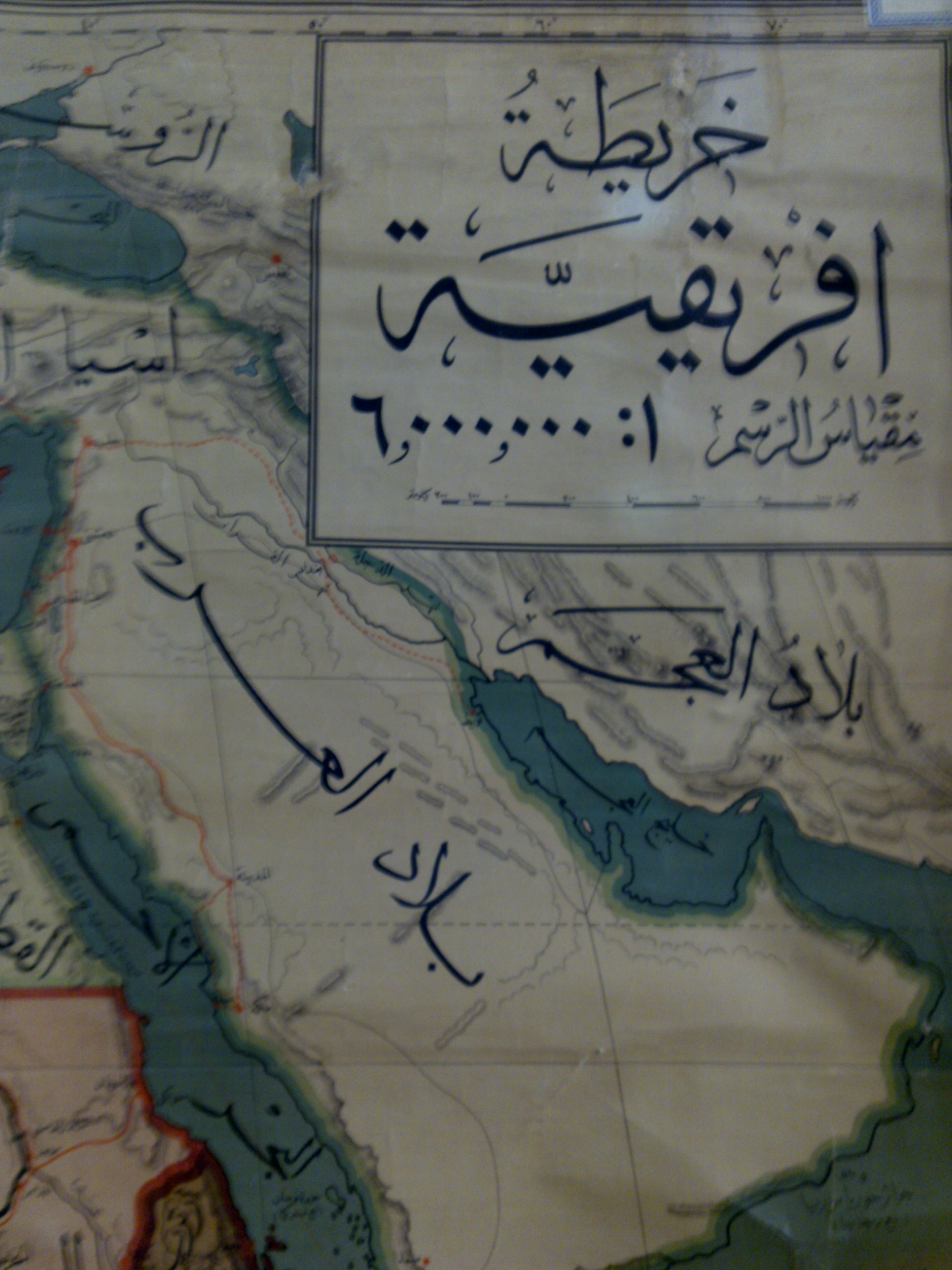
Below are two Egyptian maps of the Persian Gulf (posted in Persian Gulf On-line) in which Egyptian cartographers refer to the body of water by its correct historical name of the Persian Gulf or “Khaleej ol Faris” in Arabic.
For more see: Iran and the Persian Gulf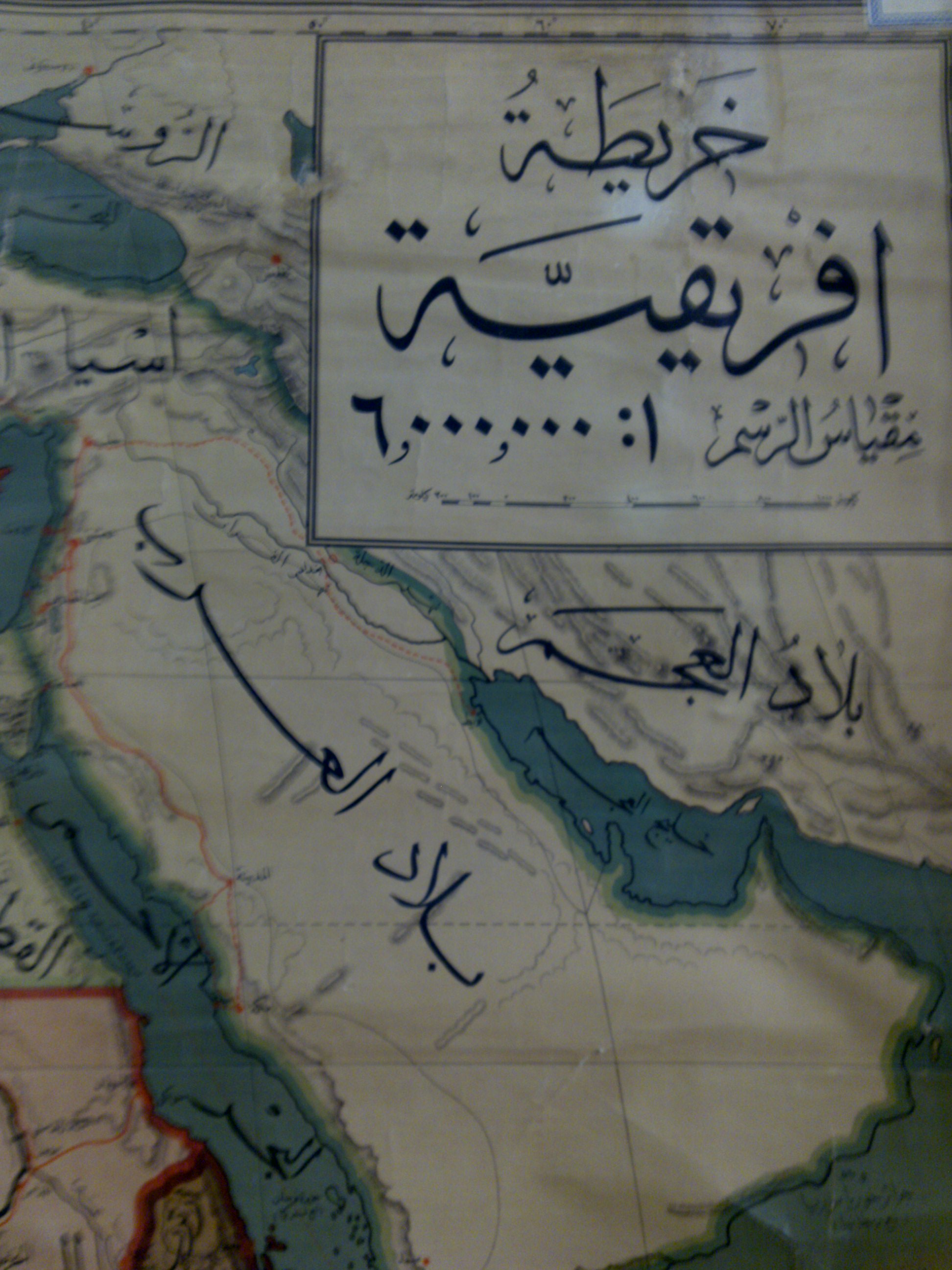
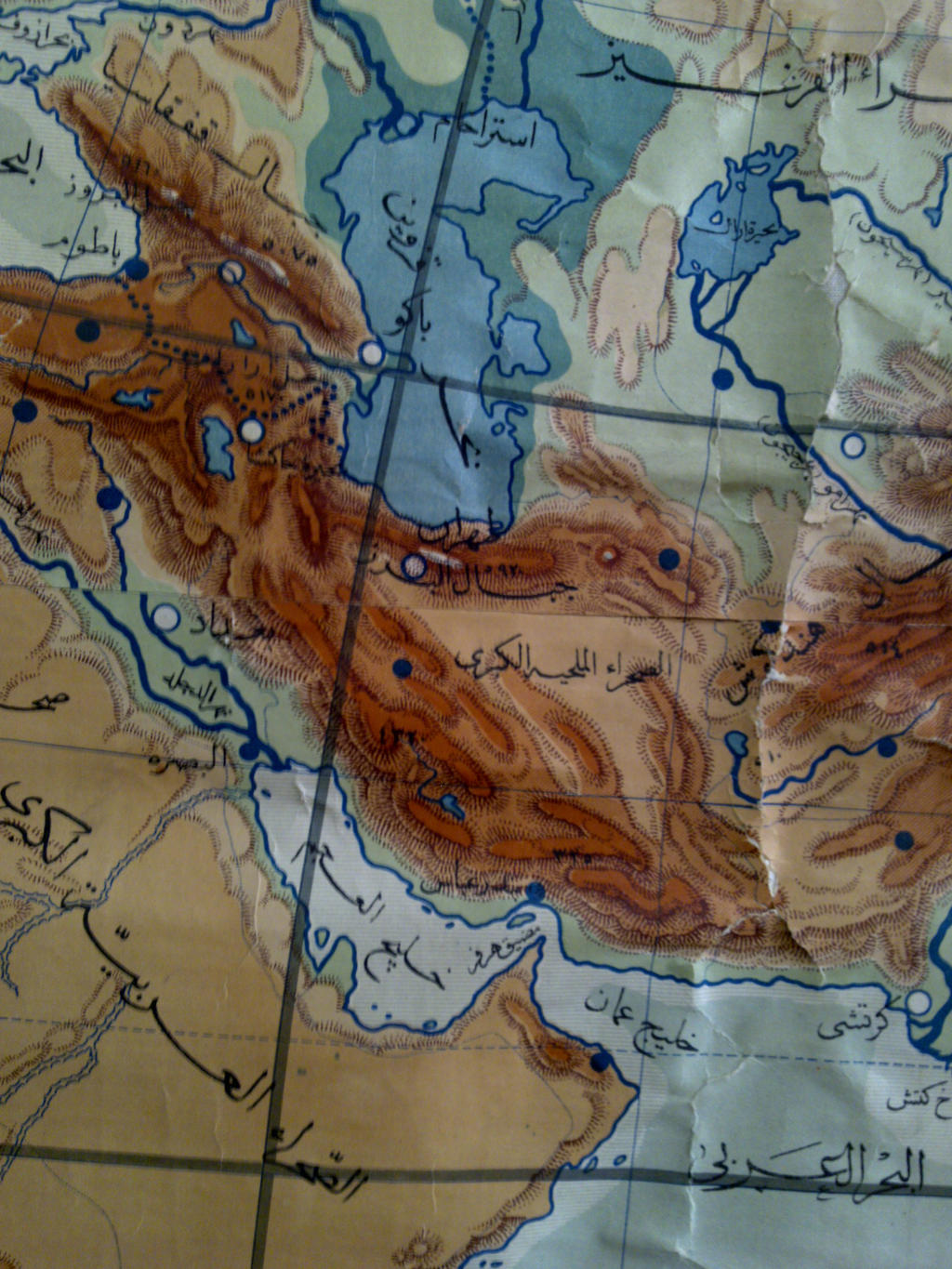 [Click to Enlarge] Egyptian map of the Persian Gulf drafted in Cairo in 1910 (Source: posted in Persian Gulf On-line).
 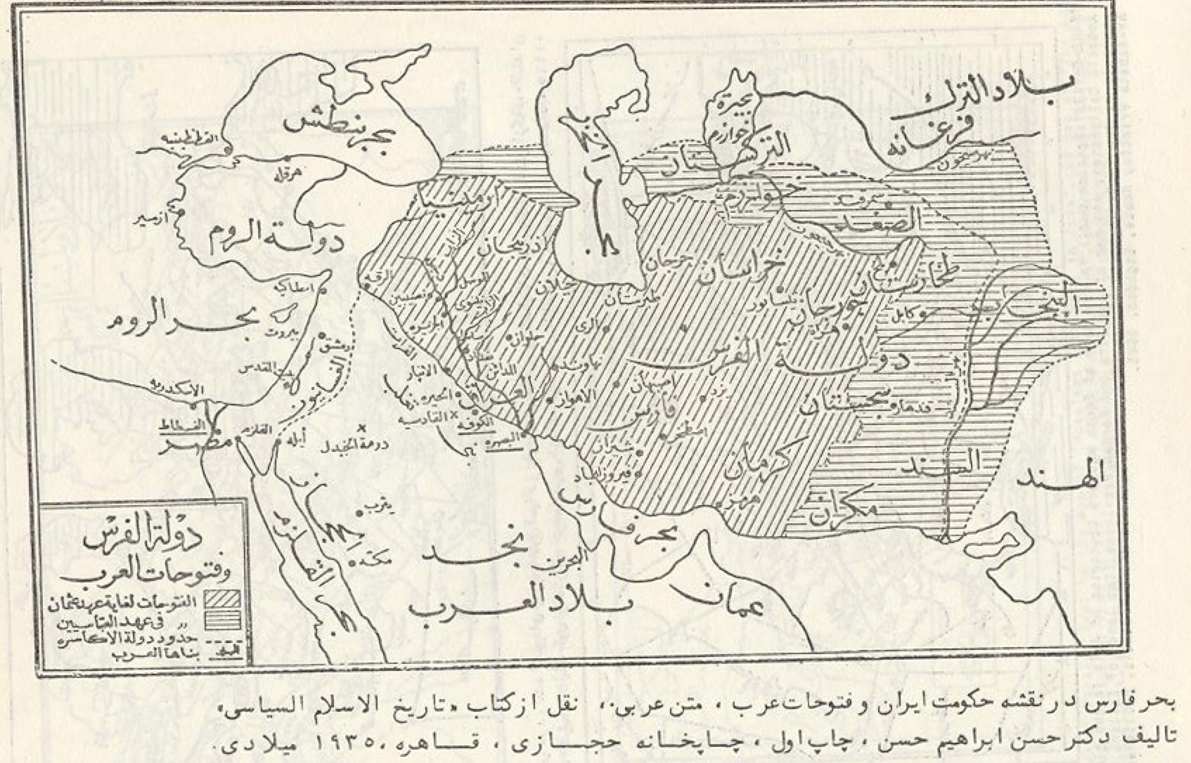 [Click to Enlarge] Depiction of the Persian Gulf by its correct historical name in an Egyptian textbook by Arab scholar Dr. H. Ibrahim Hasan, published in Cairo (Hejazi Publishing House) 1935: Tarikh al-Islam al-Siyasiya [The Political History of Islam]. Cairo: Hejazi Printing House (Picture Source: Persian Gulf On-line). The map depicts “Bahr Fars” in the above map titled “Persian government and Arab conquests”.
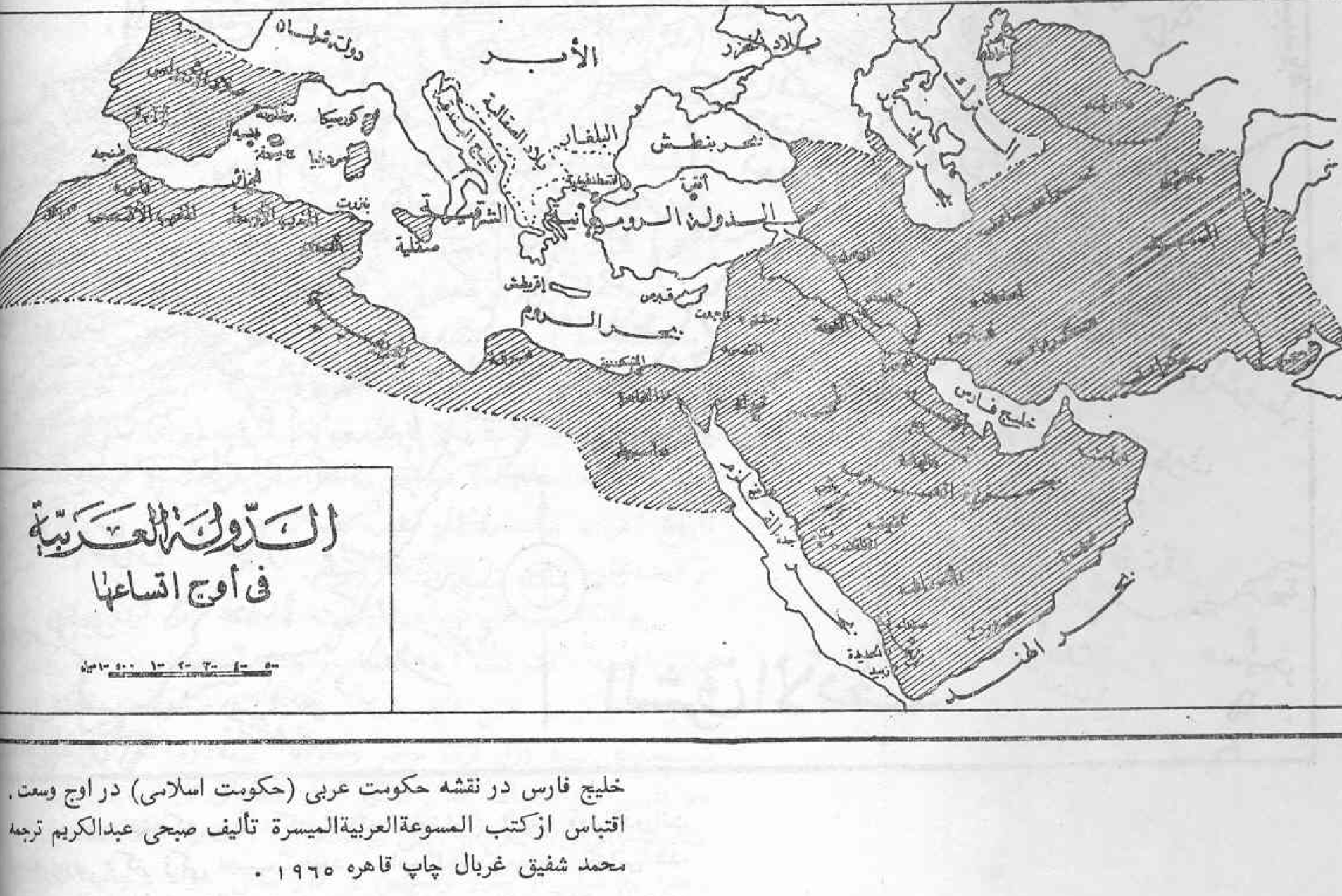 [Click to Enlarge] Depiction of the Persian Gulf by its correct historical name in an Egyptian textbook published in 1965 (Picture Source: Persian Gulf On-line). The map depicts the Islamic Caliphate at its maximum extent in the book titled: -الموسوعة العربیة المیسرة – تألیف صبحی عبدالکریم،ترجمه به عربی ازمحمد شفیق غربال،چاپ قاهره – “Al-mosuaat-a al-Arabiyya Al-Meysara” by Sobhi Abdul-Karim, printed in Cairo. This map was printed years after the late Gamal Abdul Nasser (1918-1970) began to refer to this by politically-motivated terminology.
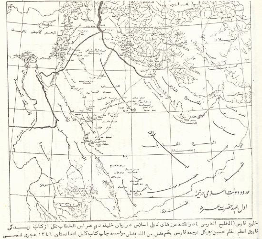 [Click to Enlarge] A case of irony: The above map “Islamic Boundaries at the time of the Second Caliphate, Omar Ibn Khattab” is from Mohammed Hassanein Heikal’s book “The life of Farouq Azam”. Heikal remains as Egypt’s world-class reporter and journalist (known as the Michael Wallace of the Arab World). Like Gamal Abdul Nasser, Heikal engaged in historical revisionism by referring to the Persian Gulf by the incorrect name of “Arab Gulf”, yet even he was obliged to publish the correct name (Bahr al-Farsi – Persian Gulf) as shown in the above book translated to Persian in 1968 by Fazlemanollah Fazli in Afghanistan (Kabul: Moasseseye Chap-e Ketab-e Kabul) (Picture Source: Persian Gulf On-line).

