The article “Iranian plateau in Pleistocene: a bridge between East and West” written by Afshin Majlesi was published in the Tehran Times on May 9, 2021. The version printed further below has been edited from its original in the Tehran Times. Excepting one image, none of the other images and accompanying descriptions appear in the original Tehran Times report.
Note that the Pleistocene era spans a time period between 2,580,000 to 11,700 years ago, a geological time-span featuring several glaciations. For readers further interested in this topic, kindly consult the following resource:
===================================================================================
A new study reinforces a hypothesis that the Iranian plateau was like a bridge between East and West during the Pleistocene epoch, which began about 2.6 million years ago and lasted until about 11,700 years ago.
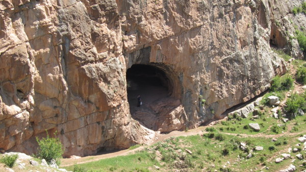
The Darband Rashi Caves in the northern Iranian province of Gilan (Source: IFP News). Hominids hav einhabited these caves from 230,000 years ago.
In an article published in the International Research Journal of Modernization in Engineering Technology and Science (IRJMETS) in April 2021, Iranian researchers Mohsen Zeidi, Cyrus Barfi, and Shahram Zare concluded that the Iranian plateau served as a human migratory pathway in the Pleistocene. As stated by the authors of the research study:
“Increasing Paleolithic finds in this region and neighboring countries (Pakistan and Afghanistan) reinforces the hypothesis that the Iranian Plateau has been used as a human migratory pathway in the Pleistocene linking East and West. The results of the archaeological survey we presented here emphasized the great potential and the importance of south-eastern Iran in general and southern margins of Lut Desert in particular, for the understanding of the Pleistocene culture history of this region …”
The survey was conducted in parts of the Fahraj-Rigan area in Kerman province, believing that new Paleolithic localities bear great potentials for this region for understanding the dynamics of Pleistocene hominid populations in south-eastern Iran. During summer 2020, and in the framework of a Paleolithic survey in the Fahraj-Rigan area in the southern margins of Lut Desert, one of the authors collected a series of surface stone artifacts and as a result of this, 12 new Paleolithic localities were identified.
The surveyed area with a semi-arid to the arid climate has a mean elevation of 700 meters above sea level and is limited to the northwest, south, west, and east by volcanic mountains. Alluvial sedimentary deposits of Quaternary origin have covered the region between these mountains. All of the recorded sites are located either along the low-height hills of Quaternary river terraces or flat alluvial deposits. The survey zone also included part of the volcanic band of south-eastern Iran which is contained mainly of igneous rock formations. Therefore, according to the authors, as the results of the geology of the region, except for a few examples, various types of igneous rocks have been used for the production of chipped stone artifacts.
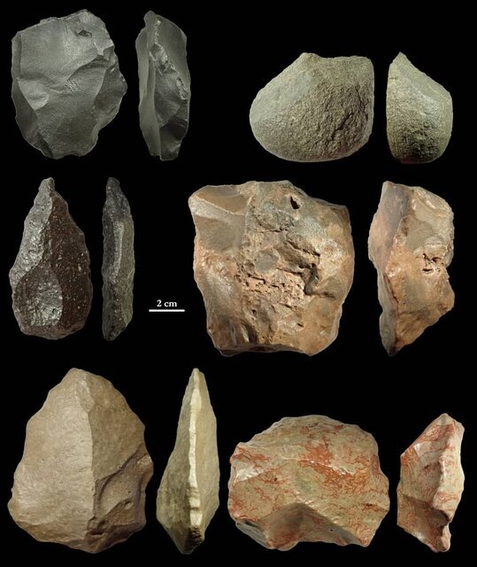
As reported by Afshin Majlesi of the Tehran Times (May 9, 2021): “A new study reinforces a hypothesis that the Iranian plateau was like a bridge between East and West during the Pleistocene epoch, which began about 2.6 million years ago and lasted until about 11,700 years ago” (Image and description: Tehran Times).
The researchers found that the abundance and relatively large size of the available raw material blocks in the region demonstrate easy access to primary and secondary sources of raw material.
Among collected stone artifacts, core-tool/core-chopper and Levallois core and flakes are the most frequent types. A large unifacial point and heavily retouched flake are between the collected pieces.
All of the stone artifacts that the researchers studied were covered with a natural post-depositional surface alteration called gloss patina, which caused smoothness, pronounced luster and, reduction of surface topography of stone artifacts.
This type of patination is considered to be typical of desert areas. However, striking platform, core removals, bulb of percussion and, flake negative removals are obviously visible on many stone artifacts. As concluded by the researchers as a result of the data of their study:
“Overall, based on preliminary techno-typological observations of the stone artifacts, direct percussion using Levallois technique mainly applied for making cores and stone tools. Therefore, it is possible to propose both Lower and especially Middle Paleolithic dates at least for five localities. However, these are the first Lower and Middle Paleolithic finds reported from the systematic survey of southern margins of Lut Desert and make this area an important and very promising area for further Paleolithic investigations …”
While the authors of the study do acknowledge that “Our knowledge about the Paleolithic of Iran is still little…” they also note that Iran in general and south-eastern Iran, in particular, has been considered as one of the major conduits or corridors for the global dispersal of hominids to the East and West during the Pleistocene era. The study explored parts of the Lut Desert (Dasht-e Lut) located in the southeast of the country which is one of the largest desert basins of high aridity in the Iranian plateau. This large salt desert is located in the provinces of Kerman and Sistan-Baluchestan.
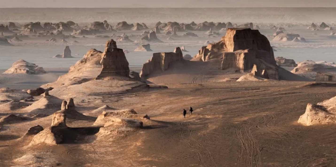
Dasht-e Lut (Source: Arkeonews).
This area was archaeologically unknown for a long period, due to its harsh climate and marginal location in the country. The first visit in the regions of Sistan-Baluchestan and Kerman was made in the 1930s by the prehistoric archaeologist-explorer Marc Aurel Stein who visited south-eastern Iran and documented many late prehistoric and historic sites in his expedition.
Based on the field observations, the surveyed areas seem to be mostly undisturbed through natural and modern human activities and our initial insight suggests that surface scatters of stone tools and debitage are usually located in the large area along the drainages and seasonal river terraces where probably water sources were attractive to the Pleistocene hominins. However, documenting the full extent of the localities and their lithic scatter needs further intensive survey. Since the early 20th century, the Iranian plateau has undergone several Paleolithic-based research. The German geologist Reinhold von Huckriede discovered a late Mesolithic site near Kuhbanan in Kerman in the framework of his geological investigations.
In 1964, Gary W. Hume at the request of Joseph R. Caldwell, director of the Kerman project explored the potential for Paleolithic sites in Bardsir valley near Kerman. Moreover, a later archaeological investigation in the Bam-Narmashir region of Kerman province revealed several archaeological sites dating from the Neolithic period to the Iron Age. Throughout history, the big and sprawling Kerman region has been something of a cultural melting pot, blending various regional cultures over time. It is bounded by the modern provinces of Fars on the west, Yazd on the north, South Khorasan on the northeast, Sistan-Baluchestan on the east, and Hormozgan on the south.

